• Seamless integration
• AI-powered support
• Enhanced communication
• Actionable intelligence
• Trusted partner
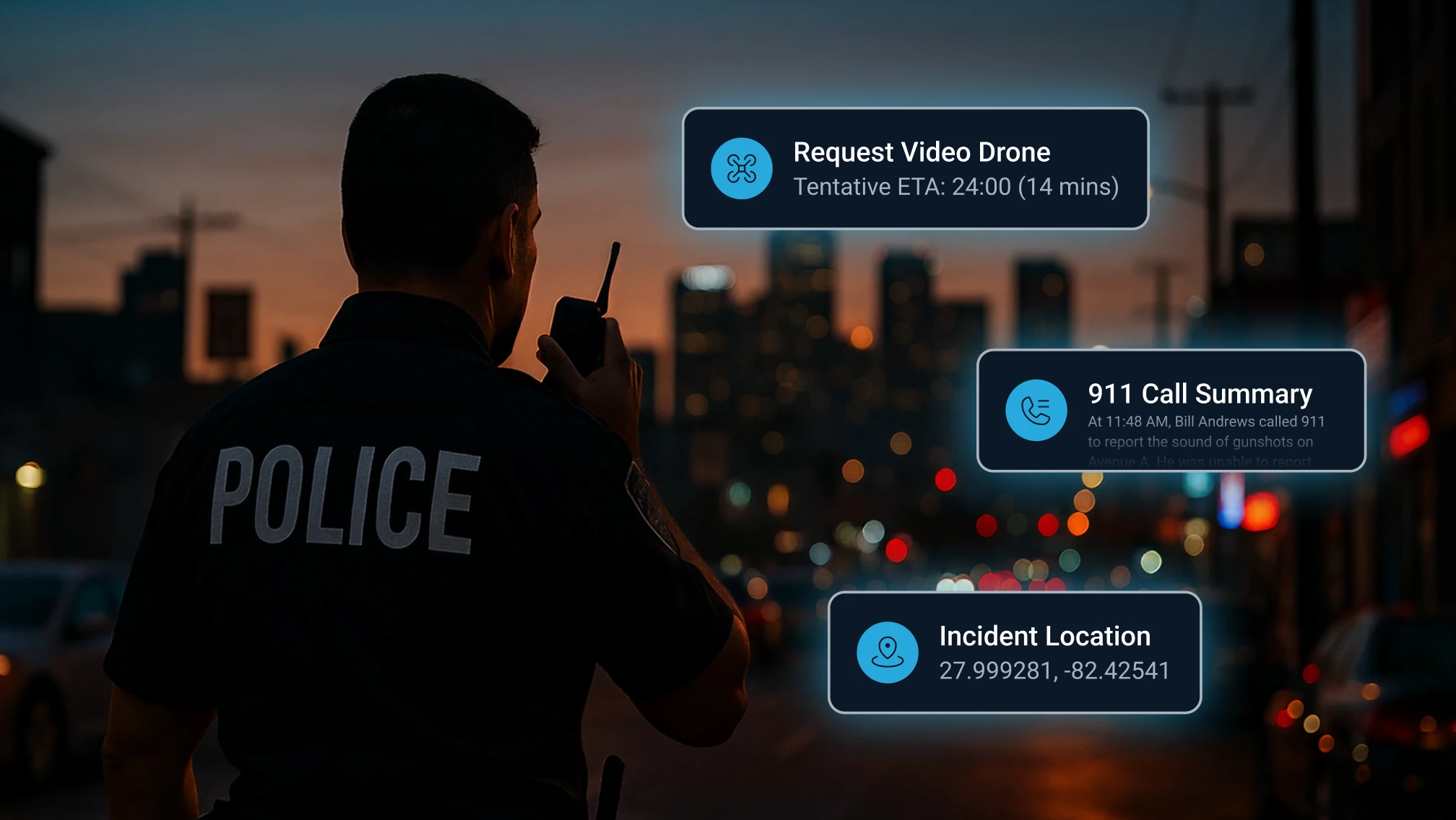
For decades, public safety has been guided by one core question: Where is the emergency? But in today’s world — where callers can mislead, suspects move quickly, and crimes unfold in seconds — where is no longer enough. Law enforcement needs to know not just location, but context. They need to anticipate patterns, verify truth against deception, and respond with confidence.
That’s the transformation RapidSOS is driving.
And as these stories from four different agencies across the country show, that shift is rewriting outcomes for law enforcement and the communities they serve.
In Germantown, Tennessee, what looked like a routine road rage incident quickly unraveled into something far more serious. A man called 911, claiming he was driving a truck and was a victim of a road rage incident on the highway.
But the dispatch team was following his breadcrumb trail in the RapidSOS mapping system, which showed he wasn’t moving at highway speed at all — he was on foot. What’s more, this location history tied his proximity to recent burglary activity in the vicinity. Clearly, something wasn’t right.
In under five minutes, the team flagged the suspicious activity, coordinated with officers nearby, and redirected the response to his actual vehicle. There officers found burglary tools and drugs — but the suspect had fled. A warrant was issued, and through the continued quick work of the field unit, he was taken into custody shortly after.
In the early hours of January 15, 2025, in Fairbanks, Alaska, a dispatcher took a call from a man who reported hearing a gunshot. At first listen, he sounded like just another concerned bystander.
But instincts told the dispatcher something was off — and RapidSOS confirmed it. While the caller claimed to be in one location, the live breadcrumb trail showed his movements elsewhere.
That discrepancy was more than a red flag. It was a roadmap. Dispatchers relayed the real-time trail to officers, who were able to retrace the exact path the suspect had walked. There, officers recovered not only the man himself, but also the discarded murder weapon he had tried to distance from the crime.
Without that trail, officers might have spent hours canvassing neighborhoods, hoping to stumble on a clue. Instead, they had definitive intelligence that turned a disingenuous story into a swift arrest and recovery of critical evidence.

When a child texted 911 from the backseat of a moving car in High Point, North Carolina, dispatchers knew that the clock was working against them.
When dealing with a text-to-911 situation, lag is inevitable — especially with a child in the backseat, trying to describe landmarks while pretending to play a game on their phone to avoid suspicion. In scenarios like this, the odds of a quick recovery are slim.
But RapidSOS breadcrumbs painted a live picture of the vehicle’s path, giving dispatchers a visual story unfolding in real-time that allowed them to guide troopers to the child’s exact location. Instead of chasing vague clues, officers had precision guidance. They intercepted the car before it was too late.
When 911 in Calhoun County, Michigan, received a call from a woman so terrified that she was unable to speak, the dispatcher knew the situation was critical. Turning to RapidSOS, she was immediately able to pinpoint the woman’s location within meters.
With these precise coordinates, she was able to dispatch help instantly. Officers arrived on the scene within moments, apprehended the suspect, and ensured the woman was safe.
The accuracy of RapidSOS location information not only gave the 911 personnel and responding units the confidence they needed to act quickly, but also the knowledge that they had a hand in affecting a positive outcome.
At first glance, these stories might seem like they’re all about location. And yes — location accuracy is critical. But what makes these moments remarkable is how RapidSOS elevates that data.
In Germantown and Fairbanks, it wasn’t just where the suspect was — it was the dispatchers’ insights and the contextual data that enabled those teams to see through deception, retrace movements, and surface information that led to evidence and identification.
In High Point and Calhoun County, it was about timeliness — turning dots on a map into life-saving speed and guiding officers with confidence instead of guesswork.
Together, these cases underscore a larger truth: The RapidSOS UNITE platform is redefining modern public safety. It’s giving law enforcement more than coordinates. It’s giving them clarity, certainty, and the ability to close cases faster — often before suspects can cause more harm.
To help public safety connect the dots, the RapidSOS UNITE intelligent safety platform uses AI and advanced technology to synthesize information from 210+ data partners to provide critical insights in one, unified view of an incident. With UNITE, dispatchers and responders work from the same playbook — reducing delays, cutting down on confusion, and giving communities the best chance at a safe outcome.